Lightcast Occupations Taxonomy
Search for Occupations ...
Surveying / Mapping Technician
Occupation
About
A Surveying or Mapping Technician works with surveyors and cartographers to gather data and create maps. Visits sites and records survey measurements and descriptive data. Selects data needed to create maps, including photos, aerial photos and satellite information, and helps produce and update maps that show boundaries or topographical information.
Career Area
Engineering
Occupation Group
Civil Engineering Technicians
Occupation
Surveying / Mapping Technician
Specialized Occupation
Surveying / Mapping Technician
Unique Occupation ID
18131210
Version
7.6.0
Related Occupations
(How does Lightcast define an occupation?)Browse the most common related occupations, based on the last 5 months of job postings data

Lightcast Occupation Taxonomy
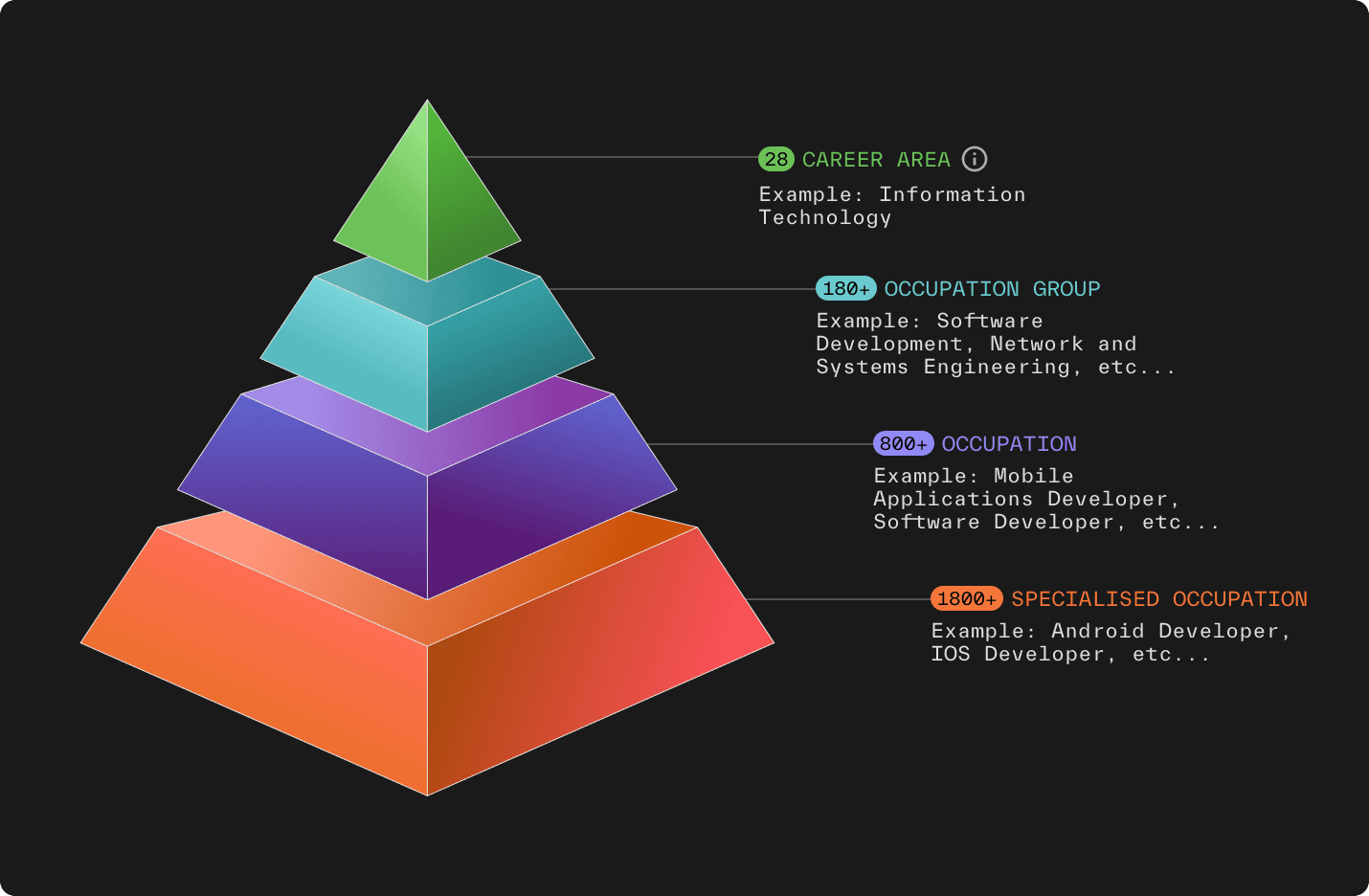
The Lightcast Occupation Taxonomy (LOT) is an advanced framework developed to classify and organize occupations with high precision and relevance to real-world labor market data. With over 1,800 specialized occupations in its library, it is designed to address the evolving nature of job roles captured from postings and professional profiles.
As we move up in the hierarchy, subsections are exclusive to their associated category. In other words, each specialized occupation is unique to its occupation, each occupation is unique to its occupation group, and each occupation group is unique to its career area. This prevents duplicate or overlapping data when analyzing more than one occupation.
The LOT uses a proprietary classification system of four different levels: career areas, occupation groups, occupations, and specialized occupations.
As we move up in the hierarchy, subsections are exclusive to their associated category. In other words, each specialized occupation is unique to its occupation, each occupation is unique to its occupation group, and each occupation group is unique to its career area. This prevents duplicate or overlapping data when analyzing more than one occupation.
The LOT uses a proprietary classification system of four different levels: career areas, occupation groups, occupations, and specialized occupations.
Browse Occupation Categories
This occupation is part of the Lightcast Occupations Taxonomy, a library of over 1,800 job occupation categories. It is the standard used by higher education institutions, public sector organizations and Fortune 500 companies around the globe.